


What if we could keep our history intact without having to see it suffer the effects of time? Imagine the impact it would have in preserving our heritage and bringing us close to our past.
With technology, we can.
The International Day for Monuments and Sites also known as World Heritage Day is celebrated on April 18 every year. It highlights the importance of conserving and promoting cultural and natural heritage around the world using affordable and innovative technology.
One of these developments is the expansion of 3D photogrammetry modeling as a low-cost method in the conservation of cultural heritage.
But what is Photogrammetry?
Let's take a look at the history and science of this technique and examine its various aspects.
Understanding Photogrammetry
Photogrammetry is the science of obtaining reliable information about physical objects and the environment through the process of recording, measuring and interpreting photographic images and patterns of electromagnetic radiant imagery and other phenomena.
Photogrammetry stems from 3 words: Photo meaning light, ‘gram’ meaning drawing and ‘metry’ meaning measurement. Therefore, Photogrammetry can be best described as the 3-dimensional coordinate measuring technique that utilizes the photographs taken as the fundamental object for measurements.
History of Photogrammetry
Let's go back to the year 1851, when a French inventor called Aimé Laussedat imagined a camera that could help collate pictures into a continuous map. However, his dream stayed unfulfilled due to a lack of technological availability. Fast forward fifty years, photogrammetry became a reality and became an unconventional, albeit highly potent use case of photography. It is believed that Albrecht Meydenbauer first coined the term photogrammetry in his 1867 article "Die Photometrographie."
Types of Photogrammetry
Broadly speaking, Photogrammetry is most commonly classified on the basis of the camera location during photography, giving us
- Aerial Photogrammetry
- Terrestrial ( Close-Range) Photogrammetry
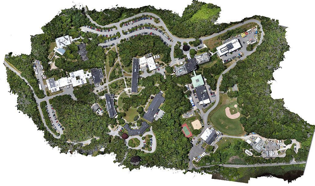
Aerial Photogrammetry

Here, the camera is taken all the way into the sky, mounted in an aircraft and is pointed vertically at the ground. In this position, multiple overlapping photos of the ground are clicked as the aircraft traverses the required flight path.
In the present context, aircrafts are often replaced by highly specialized manned craft but many drones and UAVs. In the earlier days, these photos were then processed in a stereo-plotter, which has since been replaced by automated desktop systems.
Terrestrial Photogrammetry

Here, the camera stays on the ground, operated either by hand, or placed on a tripod. As clearly apparent, this type of photogrammetry is unfit for topographic mapping. Instead 3D models, point clouds and other measurements are made using this technique. Common uses include the study of engineering structures, forensic scenes, mines, archaeological ruins and excavations, artifacts, film sets, etc.
The Principle of Photogrammetry

In the first instance, photogrammetry may come across as a complex, heavily tedious process involving heavy equipment and well trained professionals. So how does Photogrammetry really work?
Simple answer. At the core of it all, the entire science rests on one concept: Triangulation.
Triangulation basically involves shooting the required object from a minimum of two different locations, creating lines of sight. The intersection of these lines help produce accurate 3D coordinates of the desired points.
In fact, triangulation is very similar to the way our eyes perceive depth. When we observe an object from slightly different angles, our brain conjoins them to communicate volume and depth.
What makes Photogrammetry so practical?
Before we explore the many applications of Photogrammetry, let's have a look at some of the top strengths of this science. Photogrammetry is:
- Quick and cost-effective collection of data
- Highly accurate, reliable, quantifiable results
- Improved efficiency - one widely mapped area can be used for multiple analyses
- Provides an actual and permanent photographic record
- Easy to re-process data for new information without the need for expensive fieldwork to re-survey the area
- Ability to capture data in remote, unsafe or difficult to access locations, lowering safety risks
Applications of Photogrammetry
Due to its precision, Photogrammetry has gained popularity in various fields, right from medicine, engineering, and mapping, to criminology, cultural heritage, and geology.
However, Photogrammetry continues to occupy central importance in helping create aerial maps. From defense forces to government officials, these maps form the basis for making clear and informed decisions about projects, troop deployment and developmental status.
So let's explore how Photogrammetry makes the job easier for different sectors, including:
- Archeology
- Film-making and Entertainment
- Tourism and Surveying
- Forensics
- Real Estate
Archeology

Culture rests on history. And without unearthing the details of the past, we can never learn about civilization. Photogrammetry has been used for many years to uncover and conserve heritage. Archaeologists use photogrammetry to rapidly make plans of large, complex sites. Aerial photography has been widely applied for mapping excavation exposures and topology of these sites.
Photogrammetry also helps create highly detailed, fully textured 3D models from photographs to capture a range of subjects: From the most minute remain to entire landscapes, just waiting to be enjoyed, debated and interpreted!
Film and Entertainment

Ever wondered how Dune, Alita: Battle Angel and Avatar managed to create such mesmerizing environments? World-building for games and movies remains a major use of photogrammetry. Real locations are filmed, and are subsequently modeled into a dystopian wasteland, or a battlefield using a combination of 3D modeling and CGI. That’s how you get to enjoy sci-fi movies!
Tourism and Surveying
Jeju, a popular South Korean island, was partly digitized in 2019. You read that right. Missing out on a refreshing trip can be frustrating. But fret not.
With Photogrammetry and Virtual Reality, you can pay your respects to a cultural heritage in one moment and enjoy the hills in the other. With high resolution images captured by drones, and a location-based augmented reality platform to host the results, tourism can now be virtual.
Forensics
Photogrammetry to the rescue, literally. Criminal investigation relies heavily on in-depth data and extensive documentation. And with Photogrammetry, crime scenes get a lot easier to analyze and interpret, helping law enforcers close cases quicker.

Real Estate
The modern consumer no longer relies on blank promises to make purchase decisions. Being a sizable investment, Realtors have understood this sentiment and begun depending on Photogrammetry to back their claims. Using drones, an accurate image of the house and all its details are mapped out for the buyer’s convenience.

Software used for Photogrammetry
There are several Photogrammetry software to choose from. While there are some that are ideal for industrial and engineering applications, a novice can also start with programs and apps available as free downloads. All you need is a camera or phone to take pictures for the app to process. And if you have access to a 3D printer, you can even 3D print your models!
However, the most popular among the lot is RealityCapture, which is used for creating 3D models out of unordered photographs, both terrestrial and aerial. The most common fields of its current use are cultural heritage, gaming, surveying, mapping and visual effects (VFX).
Photogrammetry is an acquired skill, and is not entirely dependent on the software. It starts with the basics of photography, sharp focus with each frame, diffuse lighting, good self shadowing without cast shadows, and following a good camera path. However, which software you use will determine the final output quality of the finished image.
Final Words
The synergy of technology and awareness helps us create brilliant solutions to pressing issues. Preserving our culture and protecting our heritage is an area that requires sustained and collaborative effort to be effective.
With photogrammetry, researchers, archeologists and engineers can keep a holistic track of the state of monuments and make necessary decisions before we lose a part of our identity.


